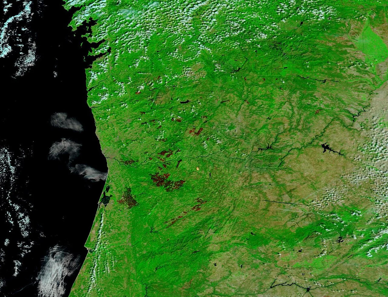
In 2017 Portugal burned about 500,000 hectares and lost more than 120 lives. In September 2024 fires across Aveiro district killed at least nine people, and in August 2025 the Arganil fire burned some 64,000 hectares — the largest in the country's record. Portugal has a national hazard map and a law that makes every owner responsible for 50 metres of fuel. This hub explains how risk is scored here, and what the record says about your municipality.
Highlighted municipalities have a published, data-backed page built on real Satelife reports for an address and a community inside them. Select one on the map to open it — or type your municipality, parish or postal code into the box below. Satelife runs address-level reports anywhere in mainland Portugal; the highlight marks where we have published the research, not where we can score.
Select a highlighted county to open its report page.
Searches the Portuguese municipalities we publish, by name, parish (freguesia) or the first four digits of the postal code. If yours is not here yet, run the address itself — we score anywhere in mainland Portugal.
2017 is the year every Portuguese fire conversation starts from. The country burned about 500,000 hectares and lost more than 120 lives: 66 in the fire that began at Pedrógão Grande on 17 June, and 50 more on 15 October, when fires driven by the winds of Hurricane Ophelia burned over 200,000 hectares across the Centro region in less than a day.
The records keep being broken. In mid-September 2024 fires across Aveiro district and the north — Oliveira de Azeméis, Sever do Vouga, Albergaria-a-Velha, Águeda — killed at least nine people, four of them firefighters, and more than 5,000 personnel were deployed with EU support. In August 2025 the fire that started at Piódão, in Arganil, burned about 64,000 hectares on ICNF's provisional report: the largest single fire in Portugal's recorded history, beating the 2017 Lousã fire, in a month in which some 3% of the country's territory burned.
The through-line is fuel and weather together: a hot, dry, windy window from July to October over a landscape where continuous plantation forest and abandoned farmland run up to the edge of villages.
Sources: Scientific Reports (2019), "Climate drivers of the 2017 devastating fires in Portugal" · iScience (2023) on the October 2017 compound event · June 2017 and 2024 Portugal wildfires (Wikipedia) · ICNF provisional report via Público and Observador, 25 August 2025.
Unlike most of the United States, Portugal publishes a national structural hazard map: ICNF's Carta de Perigosidade de Incêndio Rural (CPIR) 2020–2030, five classes from muito baixa to muito alta. It is a landscape-scale product. It does not tell you whether the 50 metres around a specific house are eucalyptus, vineyard or tarmac, which way the summer wind pushes fire across them, or what burned there in 2016.
Satelife's Portuguese reports are built for exactly that question. They read ICNF's burned-area archive back to 1975, DGT's COS2025 land-cover map around the building, Copernicus terrain, thirty years of ERA5 fire weather, fire-station drive-times on the current road graph, a fire-spread simulation and an AI read of the property imagery — and frame the result as an exposure score for operational decision support, not an official hazard classification.
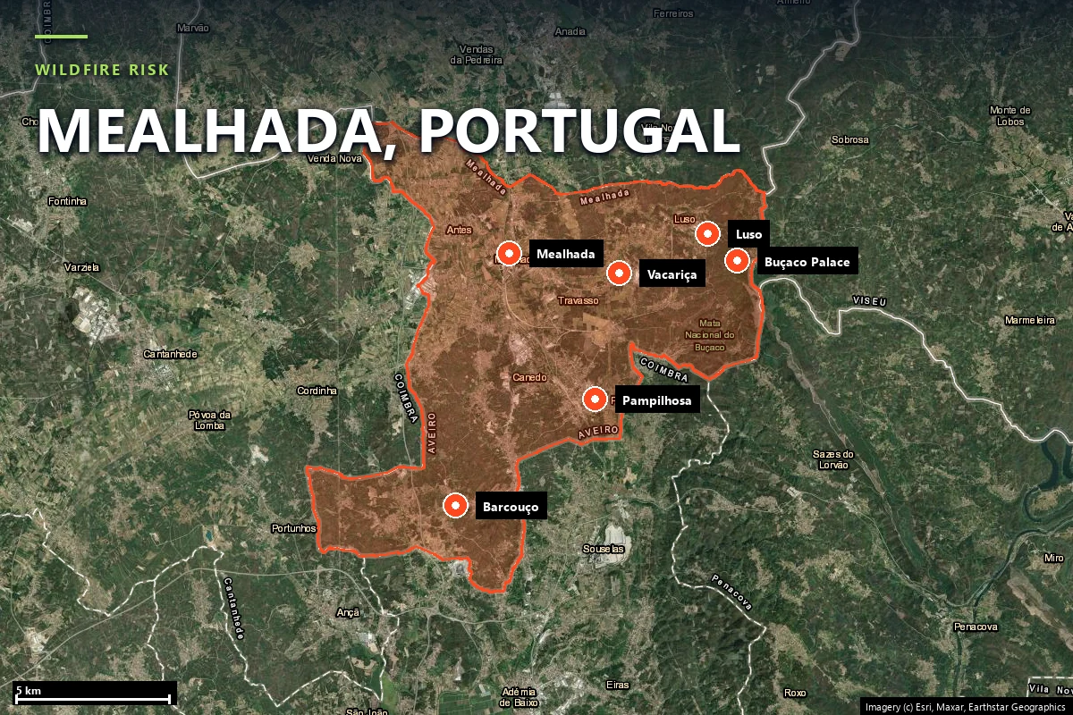
Every figure below comes from the Mealhada page: Satelife reports for the Palácio Hotel do Buçaco and the town of Mealhada, and our own clip of the ICNF and DGT public record to the municipal boundary.
Portugal's sixth National Forest Inventory (IFN6) puts eucalyptus on about 845,000 hectares — 26% of the mainland's forest, the largest area of any species — with maritime pine on about 714,000 hectares. Both are fast-fire fuels: continuous canopy over litter and shrub, often on small, fragmented private holdings.
At municipality scale the mix can be far more extreme than the national average. In Mealhada, our first municipality page, DGT's COS2025 map puts eucalyptus on 36.6% of the whole territory and eucalyptus plus maritime pine on about 86% of its forest — while the walled Buçaco forest next door, oak, laurel and cypress, has not burned in thirty-five years of mapped record.
Sources: ICNF, 6.º Inventário Florestal Nacional (IFN6) · DGT COS2025v1, clipped by Satelife to the Mealhada boundary.
Decreto-Lei 82/2021 puts the first line of defence on the owner: fuel must be managed in a 50-metre strip around buildings in rural areas, and a 100-metre strip is required around settlements. ICNF designates priority parishes each year where enforcement concentrates — Luso, in Mealhada, has been on that list every year from 2019 to 2025.
Around the owner sits the community layer: the national Aldeia Segura, Pessoas Seguras programme, run by the civil-protection authority with municipalities and parishes, covered 2,410 localities by May 2026, each with a designated refuge and evacuation arrangements. What neither the law nor the programme supplies is a building-by-building picture of where the fuel actually is — the gap an address-level report fills.
Sources: Decreto-Lei 82/2021 (Diário da República) · SGIFR / AGIF · ICNF FREG_PRIORITARIAS_DFCI · ANEPC via Observador, 21 May 2026.
Yes. ICNF publishes the Carta de Perigosidade de Incêndio Rural (CPIR) for 2020–2030, a structural hazard map in five classes from muito baixa to muito alta. It describes the landscape, not a particular building: two houses in the same class can have very different fuel within 50 metres. Satelife’s Portuguese reports are an exposure score for operational decision support, not an official hazard classification.
Under Decreto-Lei 82/2021, owners must manage fuel in a 50-metre strip around buildings in rural areas, and a 100-metre strip is required around settlements. ICNF designates priority parishes each year where enforcement is concentrated.
The fire that started at Piódão, in Arganil, on 13 August 2025 burned about 64,000 hectares on ICNF’s provisional report — the largest single fire on record, ahead of the 2017 Lousã fire (about 53,000 hectares). The deadliest year remains 2017, with more than 120 deaths, 66 of them at Pedrógão Grande in June.
Yes. The search box above takes a municipality, a parish or a postal code — the first four digits (the CP4) identify the area, so “3050-201” finds Mealhada. If your municipality does not have a page yet, run the address itself: Satelife scores any address in mainland Portugal.
Yes — mainland Portugal runs on a dedicated adapter: fire history from ICNF’s burned-area archive (1975–2025), land cover from DGT’s COS2025 map, Copernicus terrain, a 30-year ERA5 fire-weather climatology, fire-station drive-times, fire-spread simulation and an AI read of the property imagery.
Fire record, fuel around the building, fire weather and a prioritised action plan aligned with DL 82/2021 — address-level, not parish-level.
Start with your address →